Did you know there are 1.3 billion acres of private land in the US? Through property or agriculture, this comes in at around 84 to 99 million parcels. But do you know how that land is measured?
That is through a survey, and they have more uses than you might think. Read on as we discuss seven things you need to know about a land survey.
1. They Have Multiple Uses
Even if you don’t plan to get anything done to your property, the ten-year validity of a land survey can serve you well in the future. If any disputes arise with neighbors or the town planners, you have evidence to back up any questions about your property.
For example, you may have a dispute with an adjacent land owner. Perhaps a fence or outbuilding is causing a problem, and neither of you is sure whose land it lies upon. A land survey could answer this question.
You should also get one before you make any adjustments or building on your land. This can be for something as big as a new room, or as small as a storage shed. You may end up violating the property setback requirements, which can result in legal action.
2. Your Lender May Demand It
There are a number of different types of land surveys. When you apply for a mortgage to buy a house, it is common for your lender to ask for a survey. This is usually a mortgage plot plan survey, often known as an ALTA.
Its main purpose is to ensure any structures and features fall within the designated boundaries of the property. You do not want to buy a house that has an annex built over its boundaries into public property. It would cause numerous legal battles later down the line.
A check can often be made to ensure the house meets the town’s zoning laws. These are laws that state what type of property and its use can exist on a site.
3. It Requires Specialist Equipment
If you are thinking of doing the survey using your own GPS, then don’t. You will be setting yourself up for numerous problems due to its inaccuracy.
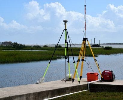
The surveyor will use a professional-grade, highly accurate GPS system. Its precision lets it measure to the centimeter. This is much more accurate than any of your commercial GPS or mobile phone GPS.
In fact, most commercial GPS systems are accurate to around fifteen feet. In terms of land, this is a lot. Especially if you make multiple mistakes and the area begins to mount up.
If you do want to do a pre-estimate, then sign up for an online mapping service. After plotting out the lines, do a search for ‘land survey near me’ and get a professional to finish the job.
4. A Land Survey Has Legal Jurisdiction
When you get a land survey, very often the results can be used in court. This means that land surveys have to be honest and impartial. Anything else, and they would be classed as fraudulent.
As such, when you get a land survey you are not able to dictate the process. Even if you paid for it, the surveyor will give you honest and accurate information. This is not something you can sway the decision on.
A surveyor will use accurate markers and historical data. This is a process using science and data. The main purpose of the survey is to protect public safety and welfare, and they could be sued for inaccurate reporting.
5. Determining if Land Is Fit For Use
Once you have the land surveyed, you can determine if the property is fit for the intended use. This usually comes down to two main factors. Do you want to build on it or use it for agriculture?
Adding a building to the land can increase its value dramatically. However, it is not as easy as digging a hole and laying foundations. You need to know the ground type, the incline, and other factors such as where pipes and underground features lie.
If you decide to use the ground for agriculture, then you need to know everything related to the specific type of crop you want to grow. For example, you may need sloping ground so water drains away easily. Combined with a soil test, a land survey should provide you with all the information you need.
6. There Are Different Types of Surveyors
Depending on what you are looking for, you may get a different type of land surveyor. Each has a different process.
Boundary and land surveyors will determine the edge of a property. They are looking for where the lines are that mark a property. It is usually used when people are building additions to the property or during mortgage negotiations.
Geodetic surveying is used for measuring large measures of land. It does this by utilizing satellite and aerial imaging. It is seldom used for residential needs.
Engineering and construction types are primarily used by civil engineers. As well as measuring roads and the locations of buildings, then also look at topography.
7. It Is a Big Task
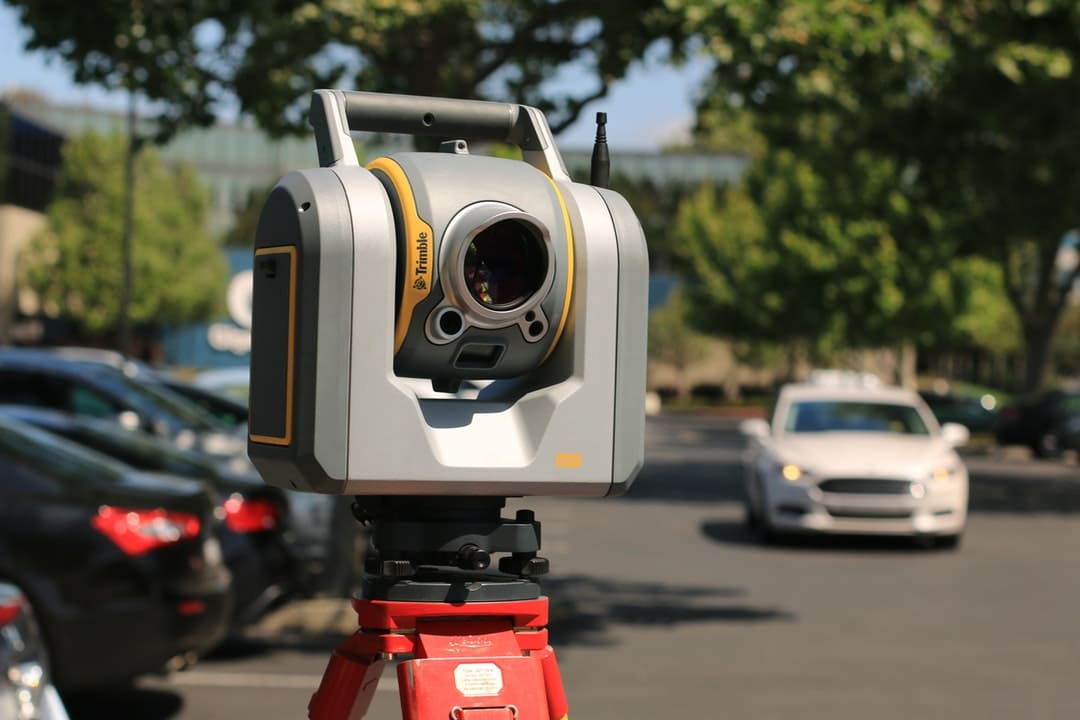
Doing a survey is a big job and the best land surveyor will not come cheap. It involves the use of theodolites to measure angles, altimeters to measure slopes, and 3D scanners to get elevation changes. Total station distance monitors measure surfaces to see how level they are, and GPS is used to take accurate measurements.
All of this equipment takes skill and experience to use properly. It can also take some time to do, then it must be compiled into a report afterward.
Sourcing a Surveyor
When looking for someone to perform a land survey, always start local. Word of mouth is the best recommendation, though you can also look online for reviews and ratings of local companies.
Your first stop should be AAA Group NY. We have expert, experienced surveyors on hand with all the latest, most accurate equipment. Contact us here to discuss your needs and let us start work on your property.


