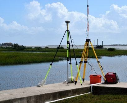
You’ve probably seen land surveyors before, standing by the side of the road with yellow vests and a variety of machines.
Land surveys are not just important for municipal and commercial properties, though. They’re also incredibly valuable for residential properties.
How does surveying work, exactly? What should it matter to you?
Keep reading and we’ll answer those questions and more.
What Is a Land Survey?
First things first, let’s define “land surveying.”
A land survey is essentially an illustration that shows precisely where the property boundaries are. This drawing will also include the location and dimensions of any site improvements or buildings on the property. They’re also tasked with mapping the topography of a given piece of property.
What Is the Purpose of Surveying?
There are a lot of different reasons why someone might order a land survey. Some possible reasons include:
- Defining property lines
- Getting title insurance
- Meeting mortgage requirements
- Settling dispute with a neighbor over the precise location of the boundary
- Locating easements
- Before building a house or other structure
- Knowing exactly what you’re buying
- Locating utilities
- Updating an outdated land survey
Accurate measurement and mapping of your property can save you from frustrating issues in the future. Having an up-to-date survey of your property is never a bad idea.
What Does a Land Surveyor Do? How Does Surveying Work?
Land surveyors are the professionals who measure properties to determine the boundaries.
Before beginning on a job, a land survey will research the history of the property. Then, they’ll go out into the field to gather more information by taking a survey of the area.
Land surveyors might use Global Positioning System (GPS) equipment during their fieldwork. GPS uses satellite data and helps surveyors collect incredibly accurate information.
The most common tool you’ll see on the site of a land survey is called a theodolite. This tool is used to measure both the vertical and horizontal angles between points. Surveyors are then able to combine those angles with distances measured from a tape measure or chain in order to triangulate the location of various points.
Modern theodolites are also known as “total stations,” and are able to measure distance in addition to angles. These tools have built-in computers that can make the necessary calculations and record data to be used later.
After the fieldwork is done, the findings are recorded through the creation of official reports and maps.
There’s a Reason Surveying Is One of the World’s Oldest Professions
Surveying land is so essential to civilization that it has been practiced since the ancient times of the Babylonians, Egyptians, Greeks, and Chaldeans.
This ancient profession is just as important today as it was in the past. Modern surveyors play a vital role in the development and management of land. Surveying is the one way to answer questions about property boundaries and topography.
How does surveying work? Now you have your answer! Is it time for you to have a land survey done for your property? If so, contact us today!


