Did you know that real estate offers the best return for your money as an investment? A recent survey confirms it and shows that the annual average is 7%. But whether you have property already or are thinking of investing, there’s one key step that you shouldn’t skip: a land survey.
If you were wondering what a land survey involves, you’ve come to the right place. Read on for more information about here in this article!
What Is a Land Survey?
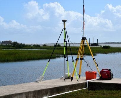
Simply put, a land survey defines the exact borders of a piece of land. A land surveyor will use modern technology to map out the boundaries, topography, and other features of a specific property. A drawing will be produced that includes all of this and any buildings, easements, other improvements.
Reasons To Hire a Surveyor
Whether you are looking to purchase a property or want to make improvements to a property you own, it’s important to hire a good surveyor. A residential land survey can locate property lines that can assist in current or future property line disputes. If you are building or making improvements, it will also find utilities, easements, and information for a mortgage and title insurance.
Most importantly, there are legal reasons to get a land survey done. If you are purchasing a property, you want to make sure that it is the correct one in the location you think you are buying. Mixups can occur with property tax IDs and the land location, more often than you might think!
Finally, if you are building a new home or addition, you want to ensure that you do not encroach upon a neighbor’s property. A survey will also ensure that you adhere to the correct building codes and regulations in the area.
Kinds of Land Surveys
When hiring a surveyor, you’ll need to establish what kind of survey you need for your property first. There are many types, and depending upon your plans, you may need more than one. Here’s a list of some potential survey types.
Boundary Survey
This is one of the most common types since it establishes the boundaries of the property. It will help you understand where your property begins and ends, which is important if you are involved in a dispute over easements, fencing, and other issues with a neighbor.
Location Survey
Similar to a boundary survey, a location survey will also show any site improvements. This is useful to have if you are going to need zoning permits.
Site-planning Survey
Speaking of improvements, if you would like to build any (or buildings), you will need a site-planning survey to mark where they will be inside the survey. This is the kind of survey that goes with building permits.
Environmental Survey
An environmental survey, or “environmental assessment,” can help you understand the impact your construction will have on the environment. It can also identify potential hazards from flooding, land contaminations, and wildfire risk in the area. Water and soil samples can be assessed and included as well.
Construction Stakeout Survey
Once you’ve finished your construction plans, a surveyor will use a construction stakeout survey to mark where the proposed structures will go on the land. This is a key part of the process to show your construction team where to build.
As-Built Survey
Also known as a “final survey,” this is the last survey performed after construction on a property. It gives an accurate representation of where structures and/or modifications have been built on the land. This is a critical survey that shows that all regulations for the local municipalities have been followed during the construction process.
American Land Title Association Survey
An American Land Title Association Survey (ATLA) is also known as a “mortgage survey”. It is done to provide lenders and title insurance companies with a survey. This is an important step for obtaining a mortgage and title insurance.
Subdivision Survey
If you have an investment property and would like to make a subdivision, you will have to complete a subdivision survey. It helps divide one parcel into multiple plots.
Topographic Survey
For a more detailed survey of the unique topography of your land, you’ll need a topographic survey. This will include any trees, streams, fencing, driveways, utilities, and so on. Because it also includes the elevation, this survey is utilized in planning any buildings and improvements.
How Much Does a Land Survey Cost?
The good news is, a land survey costs less than you may think–it’s usually around $500. Luckily, most companies will (and should) give a free estimate of the cost once they’ve visited the site. Each property comes with its unique challenges, so a price should be determined after a visit and should only be a few hundred dollars more or less than the average.
Ready To Survey Your Land?
If you’ve been wondering, what is land surveying, now you know! A land survey can help establish the boundaries of your property and do so much more. Because there are many different kinds of surveys, it’s important to do your homework and find out if you need more than one–especially if you plan to do construction.
Luckily, you don’t have to take this on all by yourself. Find a knowledgeable land survey company to be your guide in the process. Property owners in the New York area can contact AAA R.E. Servicing Corp for all of your land survey needs.


